The Brisbane Ranges are located between Bacchus Marsh and Geelong and are about 80km west of Melbourne.
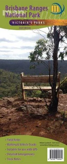
This new second edition map of the area has been comprehensively updated to ensure all map details are up to date, and includes field notes, walking & vehicle tracks, with detailed enlargements and track notes.
The national park and surrounding area is well known for:
- The wonderful spring windflowers
- Numerous short gorge walks
- Plentiful scenic picnic areas
- Steiglitz historic township
- Tourist sites and Adventure activities
- The 3-day Burchell Trail walk
Map guide includes:
- 1:30,000 scale topographic map covering the entire Brisbane Ranges National Park and Steiglitz Historic Park
- 3-Day Burchell Trail which traverses the parks
- 1:15,000 enlargement of Steiglitz Historic Park
- 10 walks with track notes and tourist information around the parks
Ideal for bushwalkers and day trippers.







![Coleman 6-Person Skydome Camping Tent - Blue Nights [2157690] Coleman 6-Person Skydome Camping Tent - Blue Nights [2157690]](https://www.joureyactive.shop/image/coleman-6-person-skydome-camping-tent-blue-nights-2157690_zOhRLx_300x.webp)
